Tuesday 21 July 2015

A walk in the Rain part 4.

I left them in bed next morning and took the path up the hill behind Carnmore. I was quickly at the high point and then it was steeply down. I followed the Abhainn Muice downstream this flowed into the Abhainn Sheallag just before this river flows into Loch Sheallag.


 Shenavail my destination for the night lay just the other side of these two rivers. By now I was very wary of river crossings but I shouldn't have worried. The first I crossed by a shingle bank that went right across the river, never more than ankle deep. The bog between the two rivers was covered with a small yellow and red flower, it had three petals yellow near the steam and red at the tip. I'm not sure what it is but it was very pretty.
 
The second river was not much deeper than the first, so I got to the bothy almost dry-footed. There was no one else at the bothy just me and the mice, and there were lots of mice. I hid my porridge from them so they chewed the rubber mouth piece of my drinking tube instead, how nice!
It rained heavily again in the night and I was very undecided about An Teallach but by morning the sun was out so it was on. The path went from the bothy up back onto the sandstone, back onto the bog. It soon met the path coming up from Corriehaillie and doubles back on itself. The bog slowly gives way to scree but it was high up on Sail Liath before it finally left the bog behind. On the second peak - Stob Cadha Gobhlach - I met a lad coming the other way he warned me of going straight up the pinnacles from this side. Apparently he'd got stuck half way down a graded climb. When I got there I could see what he meant, it looked like a typical gritstone diff. The rock was wet, I was alone and had a big heavy pack on (ok the pack was much lighter than when I started but it was still heavy). There was another path that contoured around under the pinnacles, I took it. Where it re-joined the ridge I dropped the pack and scrambled back along the pinnacles, they were much easier from this side. By the time I got back to my pack the mist had closed in and by the time I reached the top of Sgurr Fiona it was raining. I pushed on to Bidein a Ghlas Thuill, here I realized I didn't know where the decent path was, there was a ridge going north and another going east, I went east. I was a long way down, all the way to Glas Mheall Liath before I decided I was off route and. turned around. Back at Bidein a Ghlas Thuill I took the north ridge and a scree filled gully lead down onto the floor of Coire a Ghlas Thuill where I pitched up for my last wild camp of this trip.


Friday my last day, I needed to be in Ullapool for the bus the following morning. I followed the stream down to the Dundonnell road. A side road lead off the other side, a big sign at the turn warned that the Altnaharrie ferry no longer ran – such a pity. Instead I took a path up through a wooded glad up onto the moor above and onto Croftown on the main A835 Ullapool road. Seven miles along the side of Loch Broom but seven miles of road walking. After a mile it started to rain, jacket on. A mile further it got heavy, over trousers on. Another mile and a car stopped, he took me to Ullapool.

Thursday 16 July 2015

A walk in the Rain part 3

I'm away early, walking along the single track road to Diabaig, I feel almost naked without full waterproofs on. Three miles down the road and the path to Coire Mhic Nobuil is signposted. The first half mile is wooded and it's midge city, the only bad place on the whole trip. As long as you keep moving your alright but you've got to keep moving. Once out of the wood there's a breeze they're gone. The path is a good one, well made and easy to follow. I follow it for three and a half miles to Loch Grobaig. Then it's cross country on compass bearings, through the gap between Beinn Dearg and Sail Mhor. Loch Grobaig to Lochan Carn na Feola, to Gorm Loch na Beinne, to the bothy at Poca Buidhe. A sign on the door saying “This bothy is no longer open to the General Public”. “What's that about” I wonder? The heavens open I have my cag on but not my over trousers. I'm soaked in minutes, too late to stop now. I'm back on a path, along the shore of Loch na h-Oidhche, across a great open expanse of moraine covered treeless moor. It seems that after their Lordships had chucked the peasants off, after their experiment with sheep farming had failed they had any remaining trees chopped down to give them a clearer shot at the poor deer or grouse. All along this stretch I could see no where to put up a tent, so I kept on going. In the end I found a half decent pitch by Am Feur Loch almost at the road. I was quite pleased as I'd covered fifteen miles that day. All that messing about in the bog south of Glen Carron had put me a bit behind. So, if I was to get An Teallach done and get to Ullapool by Friday night (I was booked on the coach Saturday morning) I needed to get a wiggle on.
I met one cyclist on the road next morning as I walked down to Slattadale forest, there I followed the path down by the shore of Loch Maree and into Poolewe. I raided the village shop, ham and salad sandwiches, scotch eggs, cake, an orange and a can of coke, I sat on the beach and eat it all. From the village a nice well made path took me around Loch Kernsary, then through a plantation and out onto the open moors on the north-east side of Loch Maree. This is an area of complex geology, I was now off the sandstone and on the metamorphic rocks of the Moine group much better for camping on. I walked past lots of really good sites but I was set on reaching Carnmore that night so I pushed on. The path contours around Beinn Airigh Charr and under the very impressive crag of Mama's Peak before dropping down to the shores of Fionn Loch. All around were massive crags, you could loss Glencoe and the Llanberis pass twice over here. I was wandering around eyes out on storks, gob-smacked. I'd heard of this place but had no idea just how big it is. There's a causeway across Fionn Loch that saves walking all the way around, this leads to Carnmore.


There's a fancy fishing lodge and a little way beyond an old barn that climber and walkers can use. Compared to most bothies I'd stayed in this one is very basic, but I was here now and beggars can't be choosers. There was a woman in the barn, her partner and his mate were away climbing on the crag behind the barn. They'd set off at 11.00 to do a ten pitch climb, it was now 19.00 and they were still very low down on the crag and not moving anywhere very fast. She was beginning to fret. In hindsight I think maybe I wasn't that sympathetic, I'd just walked twenty miles I was tired and hungry. I took one look and said “yes, their going to be late” and went back into the barn to eat. They eventually got back sometime around midnight, I'd long since gone to bed.


Tuesday 14 July 2015

A walk in the Rain part 2.

In the morning it was raining as hard as ever, I went around to the east side of the Loch so as to avoid crossing the river lower down the valley. And then the bog trot began, I would be ankle deep in bog for quite some time. Four miles north I came to a quadi-bike track, after another two miles there was a fork in the track. The map showed the left track going to the top of a waterfall then some way further down the hillside re-starts zigzagging down. I wasn't too sure about the gap in the track. The right fork was longer but was shown as continuous, so I plumped for this one. At the bottom of the falls was Carnach, there was just a locked lodge house and no one in sight. Beyond was a good 4 x 4 track heading away north-east, a couple of miles further along another building Iron Lodge, again all locked up. At this point I walked off the Harvey's Knoydart and Kintail map, these are printed on polyethylene which is waterproof. My next map was an ordnance survey paper map, which isn't waterproof. Where was my plastic map case, not in my sack it was at home so not a lot of use. After Iron Lodge the track forked, left fork looked very steep sided with no where to camp, right fork lead to Loch Mhoicean so I headed there. Had I gone left I'd have come to a bothy but I hadn't got it marked on my map. It had rained all day, I pitched up in the rain and next day I packed in the rain.
Beyond the Loch the good track ends, there is still a track marked on the map but on the ground it's very faint. Somebody had driven a Quadi down it at some point in the not so distant past but following it wasn't easy. At some point I should have crossed over on to the east side of the stream (called the Allt Coire nan Each at this point). But I mist it and continued down the west side. About four miles further north the stream turns left (west) and becomes the Allt an Loin Fhiodha which flows into Loch Cruoshie. This was fast flowing and very deep, I followed it back up stream about a mile to where a ford was marked on the map. After looking at it and poking it with my walking poles I decided it was between waist and chest deep. It had been raining for three days so was in full spate, the water was moving with tremendous force, no way was I crossing there. Another mile up stream I found a place, there was a rock in the middle of the stream with a waterfall either side of it. Getting on to the rock was easy just a boulder hop, the other side was about four feet across and eighteen inches down onto a good wide ledge. I was aware of my heavy pack pulling me back but I took a deep breath and jumped. I was very glad to land safely on the other side. I quickly picked up the quadi track but this went north-east to Pait Lodge. I wanted to go north-west to Loch Calavie which was about two miles away. Two miles of bogs and ponds and Lochans and old glacial moraines and another river which was no doubt also in spate. This river the Allt Loch Calavie, flowed east into a line of small Lochs before flowing into Loch Monar at Pait Lodge which was about five miles away. The only bridge was at Pait Lodge, in this weather I had no other choice. There were some boats moored in the bay and a couple of quadis parked by the lodge but no other sign of life. Once over the bridge there was no sign of the track so I just followed the Loch shore until I found a place to camp. It was still raining and I was only six miles from where I'd camped the night before. 


Once again I packed in the rain, after a couple of miles I spotted the end of a 4x4 track. At last a solid surface to walk on. By the time I finally reached Loch Calavie it actually stopped raining. Waterproofs, hat and gloves off I was cruising along, past the Loch and on to Ben Dronaig Lodge where I turned north again, up by the spectacular gorge of the Black water to Loch an Laoigh. I left the track and headed up the Loch shore, just a mile away was another path that would take me to Achnashellach. Up ahead by the path I could see a roof, “could it be” I thought. But then “I bet it'll be locked”. As I walked up to the building I could see the round MBA sign, it was only 15.00 but I wasn't about to pass up on a dry roof for the night. Bearneas Bothy, just a single room but it was dry and it was great. I'd hung up my wet kit, had a brew, written my diary cooked and was just settling in for the night when I heard footsteps outside. Johann from Holland came in dripping wet as it was raining again. I'm always a little apprehensive when meeting strangers in bothies having had a few bad experiences. So I was quite re leaved that Johann turned out to be quite normal. He was doing a similar walk to me but in the opposite direction. It continued raining all night but stopped as we left next morning, he south across the bog while I went north up into the mist.

I was glad of the path as it would have been hard work micro-navigating across without it. The path went up over the flank of Sgurr na Feartaig to the top of some big crags before working it's way down some scree filled gullies. Once down that it was straight down the hillside and out of the mist. I went through a gate and into the back of a forestry plantation, it was getting warm and as I pealed off waterproofs the first midge decided to put in an appearance, the first I'd come across since Sheil bridge. Achnashellach station and the path to the next stage of my walk lay just a mile away down stream. But to get there I had to first cross the river and the bridge was as always on this trip in the other direction. Three miles along a forestry road over the bridge and four miles down the road. Up past the station, through some more forestry. In the forestry I didn't notice the difference but once out on the open hillside everything was different. The geology had changed and that changed everything. Everywhere you looked there was glacial moraine piled up in huge great heaps all covered by a thin layer of peat. The peat was so much thinner than on the schist and it was all waterlogged, so much so that there were pools everywhere. There was no where flat enough or dry enough to put a tent. I stopped near Loch Coire Lair, the way ahead looks just as bad as the ground I'd just come up. Then I met two lads out mountain biking they told me of a bothy nearby. It wasn't the way I'd planned to go but it was parallel to it, so what the heck. I followed the valley down through Scots pine to a bridge by a waterfall beyond it was a little wooden hut the Easan Dorcha Bothy AKA the tea house. There's room for about four people to sleep at the most, from the book it seems lots of the locals use it as a picnic site, and what a lovely spot.
Next day started off with waterproofs on but they soon came off as I wandered down by the River Coulin past Lochs Coulin and Clair and onto the road to Torridon. I got a lift after about a mile, he dropped me at the campsite. I pitch, throw my pack in and went in search of the village shop and some real food. It was a Sunday, they didn't open on Sundays, hay-ho. I shaved and showered that felt really good. I dozed in my tent, let my boots dry, let my feet dry. In the evening I got some chocolate and a waterproof map for the rest of my trip from the youth hostel. My OS 25 Glen Carron map is now just a sad mess.


Sunday 12 July 2015

A walk in the Rain. Part 1.

12.06.15.
The bus ride up to Sheil bridge was very boring and the campsite very full and noisy. I pitched up drank tea, cooked, then went for a walk. I checked out the start of tomorrows route then back to the tent and to bed. I was away by 07.00 next morning, around by 
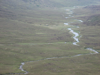
the shore of Loch Duich, at sea level, around to the turn off for Morvich. Following the faint path beside the first cottage on the left. It lead onto a more prominent track, zigzagging steeply up. This lead on to a long “V” shaped valley, the path ran up the valley but the first sister was up to the left, no path just steep heathery slopes. Up I go, as I reach the top of Sgurr na Moraich (1st sister) the clagg descends, I push on to the bealach, the path coming up the valley comes to here. Would it have been easier to come up this way, dump the pack and shoot up to the first sister unencumbered? Who knows. The second sister, Sgurr nan Saighead, comes and goes. Then the first big one Sgurr Fharan (1067m), I needed to use my hands here just for the odd move walking poles left hanging by their straps. On top check the map, check the compass. On the way down I meet my first other walkers going the other way. Sgurr na Carach, meet two young women on top both very fit, both beautiful I found myself wishing I was young and fit again. Voices in the mist on the way up the last of the sister Sgurr na Ciste Duibhe, three people appear. French, a man and two women they too are looking for somewhere to camp. It was getting late, I'd been in the mist all day, my eyes were getting tired the pack heavy. I crossed Spaniards peak (Sgurr nan Spainteach) to tired to notice, certainly to tired to think of the events of 1719.
I checked the GPS a mile to go. Bealach an Lapan at last (Bealach = col) the blue SMC guide says that this is a good place to camp, doesn't look good to me. It's a ridge if it don't slope to the left it slopes to the right. I dump the pack and head off down the Glen Sheil side hunting for water, and straight away find myself on vertical sphagnam mosse, I had to go a long way down to find the faintest of trickles. I pitch up on the sloping Bealach, tea and food only I can't eat, I forced down three spoonful's and throw the rest away. It was a cold windy wet night, I kept rolling downhill pushing the inner tent onto the fly, my sleeping bag was getting wet.


Without my glasses on I looked to my watch, I'm sure it said 07.00 so I got up, dressed and started making porridge, next time I look at my watch it's 04.10? It's light so I get up anyway, as I pack it starts snowing (two days off mid summers eve) by the time I set off it's settling. I stomp over Saileag seeing nothing wrapped head to toe in waterproofs, hat and gloves. As I approach the middle brother Sgurr a Bhealaich Dheirg there's a lightening in the mist then puff it's gone, it's wall to wall sunshine. “Wow what happened”? On top I shed unneeded layers, life suddenly feels so much better. Over the last brother Aonach Meadhoin and its little side peak Sgurr an Fhuarail then down 500m down to the Bealach a Choinich. There's a spot it's flat, it's level, it's well drained it lays between glacier worn slabs. There's a breeze so no midges. I dry my bag as I brew tea, this is better. Clear sky's during the day lead to cold nights and it was cold. Twice I got up in the night to put on more cloths, I had all my spare cloths on but was still cold. It was mid-summer and I'm wishing I'd brought my winter sleeping bag.
Day three, another day another peak, Ciste Dhubh. Steep zigzags up wet boggy slopes level out and lead onto a sharp airy ridge that in turn leads to the summit about a mile away. As I take off my pack at the summit I turn and see someone behind me “Oh, where did you spring from” we both say in unison, neither of us had seen the other and we were only 100m apart. He returned the way he came, I descended to the north, first down a ridge going north-east then I dropped off this into a wild Coire na h-Eiridh. There was a head of deer in the coire I was anxious not to spook them. I try to hug the right wall of the coire, they move off to the left of the coire. I move, they move, gradually we circle each other until I'm below them then they run back into the coire. Below me a fenced off enclosure, the contrast between inside and out is striking. Inside is so much greener, so much fresher looking. There are similar enclosures dotted around the Glen an attempt to return the glen to something like it once was. I skirt around the enclosure and cross the River Affric dry-footed. Camban Bothy lays at the watershed between Glen Affric and Glen Lichd, a posh two roomed affair with nice dry sleeping benches.


The rain returned in the night, hammering on the tin roof. It eased around 05.00 to a light drissel. The plan had been to climb Ben Fhada which was somewhere above me in the clagg but what to do in this weather? When I left the bothy it had more or less stopped raining, so I decided to push on, the track towards Glen Affric is a good one so I followed it to the foot of Ben Fhada's east ridge. This ridge faces the youth hostel at Alltbeithe so I was hoping there would be a path up it but if there was one I couldn't see it. The going on the lower slopes was very boggy and hard going up to around 800m where it levels off and becomes much more of a sharp ridge with a big drop of to the north (right) and a gentle slope to the south (left). At this point I meet a chap from Glasgow coming down from the summit, he'd climbed it from the other side and was heading for Camban. We decided we were both mad to be out in this weather as by this time it was raining hard again. He was the only person I meet in four days. I followed the edge around to the trig point the only thing to tell me I was at the top. How to get down from the top? There was a slight ridge going off to the north-east with what looked like a path going down it. Thing is it's not marked on the map and there are some big crags on the north side of Ben Fhada so the path could have lead to the top of a climb for all I knew. The map shows a path going down to the north-west so I set off to find it and straight away came to the edge of a big drop. I followed this first west then north-west and slowly it began going downward. I came to a bealach, I was only about a mile from Loch a Bhealaich where I planned to camp but there was no direct route down to it. I had to head in the opposite direction down off the ridge I was on into a coire on the west side, and then back over another bealach lower down; in all a detour of about 4 miles. Seeing a herd of Feral Goats at the bealach went some way to making up for the effort. It had been raining on and off all day so there was no chance of finding anywhere dry to pitch up, so I found the least squidgy bit of ground I could and it had to do.
Once I had my water bottle filled and was inside my little nest the weather wasn't really that important. I was dry and warm-ish and I could relax. The routine was pretty much the same each night, pull everything you need out of the rucksack. Blow up the mat and lay on it, things I don't need stay in the sack, that goes under the fly down by my feet out the way of the door. Dripping waterproofs go on top of the sack, boots next to the sack. Put the stove together and boil a pan of water for a brew. While that's heating check your feet, if your socks are wet (although at this stage of my trip they were still dry) hang them over the top of the inner tent and put dry ones on. I carry two plastic carrier type bags with me, if I need to get up in the night I put these on over my dry socks before I put my wet boots back on, that way my dry socks stay dry. In the morning the wet socks go back on. Once the water is boiled make tea then boil another pan full to “cook” the freeze-dry meal. The only way to carry fifteen days food is to use freeze-dry. They come in foil bags, you just add boiling water and eat it straight out the bag, so no washing up and your left with just the bag to carry out. It also means that I only need a small (0.5lt) pan thus saving a little bit more weight. After I've eaten I study the map for the next day, read, make notes etc. (When the weathers nice I can sit outside and take photo's, not that I did that much on this trip).

On the north side of Glen Affric is a long chain of hills from Toll Creagach in the east to Sgurr nan Ceathreamnhnan (please don't ask me how to pronounce that) in the west. I was camped below Sgurr nan Ceathreamnhnan. The great plan, dreamed up months before, was to climb up onto this ridge and follow it all the way to Toll Creagach. Then drop down to the north, cross over the dam at the end of Loch Mullardoch before exploring the hills on the north side of this Loch. Unfortunately the weather was just not sticking to the script, I had to switch to plan B. 

Sunday 5 July 2015

The new Tent.

The new tent finally arrived from California but I'd gone away for two weeks. The total cost was £181 + £38 tax. Here it is in the Alva Glen. 

I've added two guys (the orange ones) which makes it quite stable.

 I think there's a similar amount of space under the fly as the Macpac but the inner tent is much narrower. The Macpac only opens on one side and the inner fills the space on the other side. Whereas on Notch opens on both sides which means more storage space under the fly but less internal space. Headrooms about the same.
It uses walking poles as support.
The end triangles can be opened for ventilation.

With the half solid inner and the two extra guys and pegs total weight comes to 916g.